According to the Thervāda tradition of Buddhism practiced in Southeast Asian countries like Sri Lanka, Myanmar, Thailand, Laos and Cambodia there are 28 Buddhas. Sakayamuni Gautama Buddha is the 28th Buddha. The 29th Buddha is Māitreya - the future Buddha - who is yet to come. Of these 28 Buddhas, Karakchunda (Kakusandha), Kanakamuni (Koṇāgamana), Kāśyapa (Kassapa), Gautama and the Māitreya belong to the Bhadrakalpa (fortunate aeon). Both Faxian (Fa Hien, 337-422 CE) and Xuanzang (Hsüan-tsang, 602-664 CE) visited the places of the four Buddhas of the Bhadrakalpa. The places of the Karakchunda and Kanakamuni Buddha have been identified as Gothiawā and Nigliawaha in Nepal based on descriptions of Faxian and Xuanzang.
 |
| Sitā Māi temple, Closed during COVID lockdown |
Please consider supporting the Retracing Bodhisattva Xuanzang Project
How your financial support are going to be utilised
According to Faxian, the Kāśyapa Buddha’s place was called Too-wei. It was situated 50 Li (18-20 kms) west of Śrāvasti (Sāvatthi). Xuanzang does not give the name of this place, but says it was an ‘old city’ situated 60 Li (20-22 kms) north-west of Śrāvasti. Faxian saw three stūpas: i. where Kāśyapa Buddha met his father; ii. where he attained parinirvāṇa; and iii. a ‘great tope’ (stūpa) over the whole body of Kāśyapa Buddha. Xuanzang noticed an Ashokan stūpa in the south of the old city at the place where the Buddha met his father after attaining Enlightenment, and another Ashokan stūpa on the northern side of the old city containing relics of the Kāśyapa Buddha.
Based on the description of Faxian and Xuanzang, Alexander Cunningham identified the place of Kāśyapa Buddha as Tandwā. Tandwā (today Tandwā Mahant) is 14 kms west of Śrāvasti as the crow flies. It falls a little short of the distance given Faxian and Xuanzang. The discrepancy can be accommodated considering that paths taken by them were not straight lines but meandering circumventing features like forest and rivers.
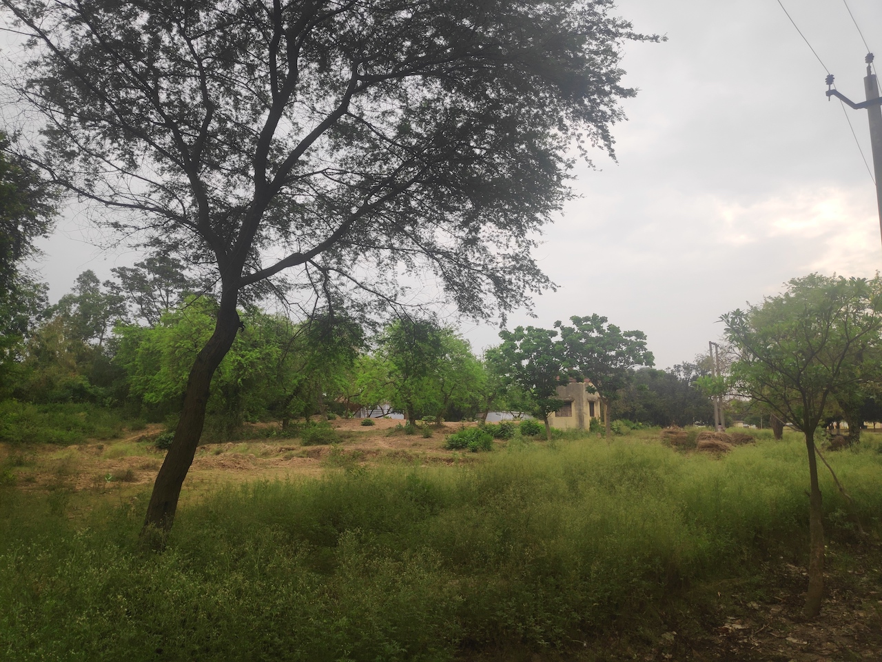
I left Sankisa on 20th March for Tandwā as my next destination on the Xuanzang trail. Walking for 296 kms, I arrived there ten days later. On the Bahraich-Shravasti highway, I turned onto a narrow unmetalled road running parallel to a 60-70 mts wide irrigation canal. After covering about 6 kms on this road, I reached Tandwā.
Upon reaching the village, I went straight to the Sitā Māi temple. As noted by Cunningham in 1863, this temple was built on the stūpa mound situated over the body relics of Kāśyapa Buddha. Since the visit of Cunningham, the temple has grown from a small shrine into a sprawling complex. Today, the temple is a major Hindu place of worship in the region and the main attraction in the village. Due to COVID19, the temple was closed. I met a pujāri (priest) in the temple named Shri Tilak Ram and asked him where I could find the Mahant (head priest). He informed that the temple was no longer under the jurisdiction of the Mahant but under the Gram Panchayat of Tandwā so the affairs of the temple were managed by the Pradhān (village head).
Tandwā was visited by Cunningham in 1863 and 1876. Cunningham recorded several aspects of the village.
- Cunningham was told the town (Tandwā) belonged in ancient times to Rājā Suhir-dal. After the death of this King, the town was destroyed by the Muhammadans and remained uninhabited until about one hundred years ago when a Bairāgi (ascetic) named Ajudhya Das took a place for himself under a Banyan tree. Ajudhya Das discovered a female figure which is now worshipped as Sitā Māi (mother Sitā).
- Cunningham noticed the village Tandwā is situated amidst brick ruins one-quarter of a mile to the north of the road leading from Akaona to Bahraich. Cunningham noticed broken ancient bricks scattered in the fields around the village. Around 1000 ft to the north-west of the village, he saw a mound of brick ruins 800 ft long from east to west, and 300 ft wide. He called this ‘mass of ruins’.
Cunningham noticed that the west end of the ‘mass of ruins’ was very low, but it was covered with broken walls and fine trees, and was therefore most probably the site of the monastic establishment. The average height of the east end of the wall was 16ft above the fields, but rose to 20ft in the south-west corner. At this point the mound is formed of solid brick-work, which, after close examination, I discovered to be the remains of a large stūpa. Cunningham was convinced that these remains were the same as the Ashokan stūpa mentioned by Xuanzang and the ‘great tope’ mentioned by Faxian.
Cunningham made some excavations and established that the stūpa was 74ft in diameter, 5.6ft above the paved courtyard and 18ft above the level of the fields. The ruined mound of the stūpa, all of solid brick-work, was still 9ft in height above the berm and 14.6ft above the floor of the court in which it stood. Some parts of the massive walls of the courtyard were still standing and the complete size could be traced by the lines of the brick ruin. It was 365ft in length from north to south and 160ft in breadth with a small outer court at each end 160ft by 100ft.
Cunningham cleared out the rubble collected around the great stūpa. But he could not excavate the top of the stūpa since it was occupied by the Sitā Māi temple. He found the flights of steps on the north and west sides of the stūpa nearly perfect and the outer wall of the stūpa still standing. Cunningham concluded that a boundary of stone railing existed around the stūpa. He also found a piece of a rail bar, several fragments of stone coping, and some pieces that he believed to be part of an architrave or curved beam of a Toran gateway. All these fragments were found in one spot near the northern entrance. According to Cunningham, the great mass of stone chips collected on this spot were perhaps because the people who came to occupy the mound employed mason to cut bricks and sculptures out of the stūpa and reuse it. Cunningham examined thousands of these fragments. Two items of significance were: i. A half life-size head of the Buddha measuring 3.75 inches in height and 3 inches in breadth; ii. A piece of railing carved with ornamental flowers on top and an inscription on the face - Sthahanwa-Aaraa {ma) (the Sthahanwa monastery) - mentioning the site to be a Buddhist monastery named Sthahanwa.
- Cunningham noticed an isolated mound 500ft to the west of the stūpa which appeared to be the remains of a small monastery. The traces of walls showed an 80 ft square placed with towers on the four corners.
- A little further to the west-north-west at a distance of 3700 ft from the stūpa is a long low mound more than 800ft from north to south and 500-600ft from east to west which may have been the site of the old town. At the time of Cunningham’s visit, it was a recently-established village called Allah-bakshpur. According to Cunningham, the mound represented the site of the old town that was visited by Faxian and Xuanzang. It was called Bar-ki-bhaari, or “Banain tree mound.”
- Near the south side of the stūpa are the remains of several buildings marked with letters A, B, C, D, E, F on the map. Cunningham made excavations at all these spots but they turned out to be small isolated buildings, probably private dwellings, containing two to three rooms each.
- There is a small round-shaped mound 300 ft to the east-south-east of the great stūpa which from its appearance can be suspected to be the remains of a second stūpa. This stūpa would accordingly represent the scene of Kāśyapa’s interview with his father. according to Xuanzang, here Kāśyapa also sat in meditation and acquired supreme intelligence, or, in other words, became a Buddha.
- Cunningham found a great Banian tree exactly on the site of the eastern entrance which he thought to be the original tree under which Kāśyapa was believed to have attained Buddhahood. Beside this great tree, Cunningham found eight other fine Banian trees on the mound around the stūpa. The positions of all these are marked in the map by figures from 1 to 9.
 |
| Archaeological notices at Tandwā plotted by Cunningham |
 |
| Dimensions of ‘Ashokan stūpa’ plotted by Cunningham |
I checked the temple out to see how much remained of that which Cunningham recorded nearly two centuries ago. I found that much has changed but the mound noted by Cunningham - the ‘mass of ruins’ - is still very prominent. The summit of the mound according to Cunningham was in the south-west corner which is actually on the north-east corner. According to Cunningham, the highest point on the mound were the remains of the ‘Ashokan stūpa’ mentioned by Xuanzang or the ‘great tope’ mentioned by Faxian and on top of the ‘Ashokan Stūpa’ the Shiva Linga and Sitā Māi temple. Both the temples are bigger now than Cunningham’s time.
Cunningham recorded that the stūpa was situated in a courtyard 365ft in length from north to south and 160ft in breadth. Today, this courtyard has many permanent and makeshift cottages in which ascetics of different sects live and there are places for the vendors selling snacks, flowers and puja materials. The whole of the courtyard is now covered with modern constructions. On the south-west corner the ‘mass of ruins’ is exposed and fairly damaged. A lot of pits, made by removing bricks, can be seen. The southern side of the ‘mass of ruins’ now has an electric substation and a park by the Horticulture Department of the government of Uttar Pradesh. The west end of the ‘mass of ruins’ which was proposed by Cunningham as the site of the monastic establishment has now a government-run cowshed (Gaushālā).
 |
| Identification offered by Cunningham plotted on the Google Map |
 |
| Empty campus of the Sitā Māi temple |
 |
| Inside one of the Ascetic cottage in the Sitā Māi temple courtyard |
 |
| Waiting foe the lockdown to get over. A musical instrument player outside the Sitā Māi temple |
 |
| Garden of Horticulture department on the 'Mass of ruins' |
 |
| A view of the 'Mass of Ruins' from south |
 |
| Cow shed on the 'Mass of ruins' |
After checking out the temple, I was curious to know about the maṭha (Hindu monastery) which managed the Sitā Māi temple at the time of Cunningham’s visit. Walking through the narrow by lanes with a couple of local youths I arrived at the centre of the village. A very old, dilapidated building stood there. It appeared as if it would collapse at any moment. I was told the current Mahant lived there. He was not present at home at the time.
A group of people came and surrounded me out of curiosity. I asked them about the places where they have found big-sized bricks - this is the easiest way to know about the ancient remains. They had spotted such bricks at several places: in Hanumangaḍhi situated slightly to the north-east of the village; in the ruins on the west side of Sitā Māi temple complex; and in the south-east side of the village where the Panchayat and community centres are located. I asked them if they ever discovered stone sculptures or terracotta statues. All of them shook their heads at the same time indicating a ‘No’. The places mentioned by people where they had found large bricks was the same set of places mentioned by Cunningham as containing ancient remains. Some children guided me to the Hanumangaḍhi mound. It was situated at the turning of the road and was very badly damaged. It had a small stone image of Lord Hanuman sitting over the mound. It was obvious the mound was serving as a brick quarry now.
 |
| Mahant quarter in very bad shape |
 |
| A view of street in Tandwā |
 |
| Interacting with the youth of Tandwā |
 |
| Hanumangaḍhi mound. A brick quarry now. |
 |
| Hanumangaḍhi mound. A brick quarry now. |
Xuanzang mentions two stūpas related with Kāśyapa Buddha: the first over the Body relics of Kāśyapa Buddha and a second at the place where Kāśyapa Buddha had interviewed his father. Cunningham proposed the hanumangaḍhi mound as the second stūpa mentioned by Xuanzang. If, as Cunningham proposes, the Sitā Māi temple is the first stūpa (over the body relics of Kāśyapa Buddha) then the second stūpa mentioned by Xuanzang (marking the site of Kāśyapa Buddha’s interview with his father) should be on the southern side of the Sitā Māi temple mound. Hanumangaḍhi is on the north-east side of the Sitā Māi temple mound so it does not fit Xuanzang’s description of the second stūpa. Hence, Cunningham’s identification of the second mound is incorrect. Regarding the ‘old city’, Cunningham identifies the village of Bar-ki-bhaari as the ‘old city’ of Kāśyapa. Xuanzang places the ‘old city’ on the south of the relic stūpa. Village Bar-ki-bhaari is on the north-west side of ‘Relic stūpa’. Therefore, Cunningham’s identification of the ‘old city’ is not in consonance with Xuanzang.
Cunningham did not find even one inscriptional evidence to establish Tandwā as the place of Kāśyapa Buddha. So can Cunningham’s identification of Tandwā as the place of Kāśyapa Buddha be wrong?
Discovery of inscription is not an imperative for identification of a place so long as circumstantial evidence is compelling. We have numerous Buddhists sites where no inscriptional evidence was found yet the circumstantial evidence is so compelling that the identifications are taken as correct. Some examples that come to my mind are Veḷuvana (Bamboo grove, Rājgir), Griddhakūṭa (Vulture’s peak, Rājgir), Saṅkāsya, Gurupāda, Kapilavastu (Tilaurakot), Yasṭhivana (Jeṭhian). Tandwā is a very promising site for Kāśyapa Buddha. Findings by Cunningham have established that Sitā Māi mound was a big stūpa, and a Buddhist monastery named ‘Sthahanwa.’ But this place needs a lot more exploration and excavation to identify the ‘old city’ and the other shrines mentioned by Xuanzang.
 |
| Interacting with Shri Ajay Tripathi, the village head, Tandwā |
In the afternoon, I got the opportunity to meet the Pradhān (elected village head) called Shri Ajay Kumar Tripathy, a man in his late 60s. According to him, Tandwā presently has around 450 households, most of whom have a meagre existence. They own very little land and generally work as daily-wage labourers.
In ancient times, Tandwā was the seat of Luv - the son of Lord Rāma of Rāmāyana. And at the place of Sitā Māi Temple was a Jānki Temple where Sitā, the wife of Lord Rāma, gave birth to her twins, Luv and Kush. The Sitā Māi temple site comes under the Grām Panchayat but its land belongs to the Archaeological Survey of India (ASI). In 1990, during a casual digging on the mound, villagers discovered a large femur bone which is currently in possession of ASI Lucknow. Village Head Ajay ji was told by the ASI that the skeleton belonged to the 2nd CE (Kushan period).
Ajay ji explained to me that after India became independent (1947), the Tandwā maṭha (Hindu monastery) offered the Sitā Māi temple to the Panchayat of the village. He said the Tandwā \ were very rich, having many monasteries all over India. They owned a lot of land in Tandwā until 1980’s when a corrupt Mahant (head of monastery) illegally dispossessed them of most of it.
Ajay ji was not very pleased with the attitude of ASI which, he says, “just wants to acquire land and is not interested in developing the place”. When I asked him how the mound came to be so badly damaged, he told me that there is no ASI guard on duty to protect the site: “[As village head], I am doing whatever I can do, I am doing my best”. The Sitā Lake (Cunningham’s Sitā-dohar-tāl), 735 acres in size, which was a part of River Rāpti also belongs to Tandwā Panchayat so comes under his jurisdiction but has been taken over by the Forest department therefore he cannot do much for its development.
In his report, Cunningham has mentioned an image of ‘Sitā Māi’ which stood inside the Sitā Māi temple - 3ft 4 inches in height carved from Mathura sandstone. Cunningham shares a very interesting story: when he brought the statue outside of the temple for the purpose of being sketched, Cunningham asked his Brahmin attendant to clean the statue and wash it, a woman in the crowd said, ‘Look how Sitā is weeping at being brought outside the temple.’ According to Cunningham, this image of Sitā Māi was actually ‘Māyā Devi giving birth to Bodhisattva Siddhārtha’ not Sitā Māi as worshipped by villagers. According to Dr. Elora Tribedy (Deccan University), who is a scholar of iconography, the image of ‘Sitā Māi’ is actually Yakshi (protecting spirits, female deities) belonging to pre-Buddhist and non-Vedic tradition (folk religion). It is not ‘Māyā devi giving birth to Bodhisattva Siddhārtha’ as proposed by Cunningham. During Maurya (3rd BCE) and Shunga (2-1st BCE) periods, the Yakshi cult was very popular.
I was very keen to see this much debated image of Sitā Māi and photograph it but the temple was closed because of COVID19. On my laptop I showed Ajay ji the image of ‘Sitā Devi” published in the reports of Cunningham. He recognised it immediately as that image of ‘Sitā Māi’ stolen in 1972 from the Sitā Māi temple. Following Cunningham’s visit in 1876, the temple fell into ruin because of the apathy of maṭha administration. The image of Sitā Māi got buried in ruins. In 1948, the temple came into the custody of Grām Sabhā (Panchayat) who undertook its renovation. Further renovation was initiated in 1958 and completed in 1962. But in 1972, the image of Sitā Māi kept inside the temple was stolen and never recovered. The Panchayat replaced it with another image of Sitā Māi brought from Jaipur.
I told Ajay ji about my foot journey and why I was at Tandwā because Xuanzang had visited this place. Ajay ji said he was aware since childhood about the Buddhist past of Tandwā. He had seen Buddhist pilgrims come in good numbers from Śrāvasti during the pilgrimage season. He knew about the visit of Chinese monk Xuanzang in ancient times. He told me something new also - about a shelf in an ancient railing pillar kept in the Sitā Māi temple premises where Xuanzang lit a butter lamp when he came to the temple. I didn't know how to react to his story. Stories like these are concocted by priests in such sites. I keep coming across them.
 |
| Yakshi (Sitā Māi of Villagers / Māyā Devi of Cunningham) Sketch from the ASI Report. |
 |
| Shelf in the railing pillar. |
 |
| Sitā Lake |
 |
| A cottage with Buddhist flags on it |
 |
| Shri Ram Sware in the 'Buddhist cottage.' |
The encouraging thing is that many Buddhist institutions in Śrāvasti are aware of the Buddhist past of Tandwā and go to visit the site. Tandwā is just 14 kms from Śrāvasti and is very most appropriate for a walking pilgrimage trail linking Śrāvasti to the place of the Kāśyapa Buddha. I hope to walk this trail someday myself together with the Saṇgha.
 |
| Myself walking on the road from the Abode of Kāśyapa Buddha (Tandwā) to Śrāvasti |
Story chronicled by Dr. Aparajita Goswami
Bibliography:
Beal, S.; 2005, Travels of Fah-hian and Sung-Yun, Buddhist Pilgrims from China to India, Low
Price Publications, Delhi: (Originally published London: Trubner and Co.: 1869).
--------------. 1914, The life of Hiuen-Tsiang by Shaman Hwui Li, Kegan Paul, Trench Trubner &
Co. Ltd, London. (New Edition 1911).
Cunningham, A.; 1871, Archaeological Survey of India Four Reports Made During the Years 1862-63-64-65, Vol-I. Simla: Printed at the Government Central Press.
—— 1880, Archaeological Survey of India Report of Tours in Gangetic Provinces from Badaon to Bihar in 1875-76 and 1877-78. Vol. 11. Calcutta: Office of the Superintendent of Government Printing.
—— 1871, The Ancient Geography of India - I: The Buddhist Period. London: Trubner and Co.
Watters, Thomas; 2004, On Yuan Chwang’s Travels in India, (Edited by T. W. Rhys Davids and
S.W. Bushell), Reprinted in LPP 2004, Low Price Publications, Delhi. (First published
by Royal Asiatic Society, London, 1904-05), ISBN: 81-7536-344-4.
Source of Pāli references: http://www.palikanon.com/english/pali_names/dic_idx.html
● P.T.S. means published by the Pāli Text Society.
● D.=Digha Nikaya, 3 vols. (P.T.S.).
1 comment:
A marvellous journey in the unknown corners , that inspires to be part of the adventure and instigates quest in mind about Buddha and his contribution to this world.
Post a Comment