 |
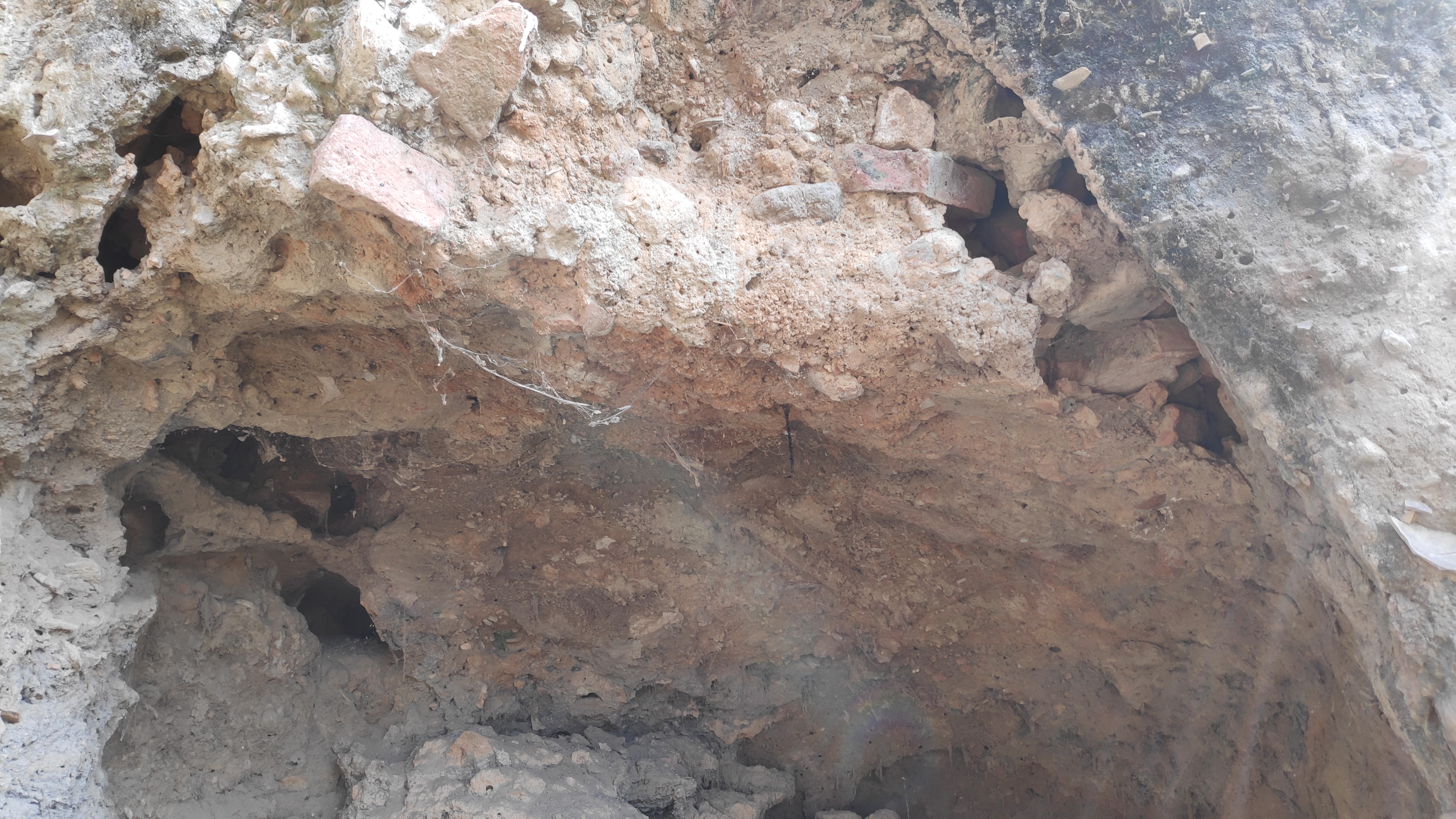
Ancient brick in the wellhead, Khamabhauli. |
Xuanzang (Hsüan-tsang, 7th CE) traveled more than 100 Li SE from Kanyākubja (now Kannauj) to reach Navadevakula. Navadevakula was a city situated on the eastern bank of the Ganges River (Rongxi 1996: 132). It was over 20 Li in circuit which is like 6-7 Kms. Cunningham in 1878 identified Newal (26° 54' N. 80° 10' E) near Bangarmau as the remains of ancient Navadevakula (Cunningham 1880: 48). Faxian (Fa-hein, 5th CE), like Xuanzang on his way from Kanyākubja, had crossed Ganges and traveled 3 Yojan South i.e. approximately 30 kms to arrive at a place called A-le meaning forest (Legge 1886: Ch XVIII). At A-le Faxian saw stūpas where the Buddha preached law. Cunningham thought Faxian and Xuanzang were referring to the same place (Cunningham 1880: 47).
On my foot Journey I arrived at Newal on October 18, 2022. As I approached the Newal from the NW direction I noticed a huge irregular mound running from NW to SE. The mound was up to 4-5 ft high, and extended as far as I could see on my left and right side. I was later told the mound is almost 1.5 kms long and up to 600 meters wide. The newly constructed Lucknow-Agra expressway is situated on the NW border of the mound. The mound gets very prominent, rising up to 30-40 ft on its SE corner. The highest part of the mound i.e. the SE corner has two villages Newal and Jagtāpur settled over them. A large part of the mound is now farmland, littered with brickbats everywhere. A few farmers whom I met informed me how occasionally they keep discovering ancient antiquities in the form of stone sculptures, metal implements, corroded utensils and of course a plethora of ancient potshards.
My host shri Praveen Kushwaha is a neo Buddhist and is well aware about the rich ancient past of his village, Newal. He took me around the village and showed me how the mounds were destroyed indiscriminately during the construction of the expressway in the mid 2010s. Developers of the Lucknow-Agra Expressway needed lots of earth and these mounds became easy prey. Farmers got lured by the handsome money offered by the Expressway developers. Ancient mound, the remains of Navadevakula of Xuanzang now has scars left by Expressway developers all over it.
 |
Shri Pravesh Kushwaha showing the scars on the Newal mound. |
 |
| A farmer in Newal showing what he just found while ploughing the field. |
In the evening I discussed the two Ashokan stūpas mentioned by Xuanzang with my hosts. Emperor Ashoka erected these stūpas to mark the places where the Buddha gave sermons. The first Ashokan stūpa was situated 200 paces in front of a Buddhist monastic complex. The monastic complex consisted of three Sarvāstivāda monasteries where more than 500 monks practiced. The monastic complex was 5 Li east of Navadevakula i.e. 1.5 - 2.5 kms East of Newal. The 2nd Ashokan stūpa was situated 3-4 Li North of the Sarvāstivāda monastic complex.
 |
Map 1. Ancient Navadevekula, and the two Ashokan Stūpa sites plotted on GE map. |
 |
| Map 2. Ancient mound of village Bhagwantpur Gote depicted on GE Map. |
 |
Map 3. Ancient mounds in Khambahauli depicted on GE map. |
Cunningham in his survey of Newal identified mounds in Bangarmau with the remains of Buddhist monasteries and Ashokan stūpas of Xuanzang. Bangarmau is situated South-South-East of Newal. I was not convinced with the identifications offered by Cunningham. Instead, I thought we should look for the Buddhist remains in the villages situated exactly East of Newal. I had done some homework by plotting the probable places on Google Earth that may match Xuanzang descriptions. After carefully examining the neighborhood of Newal on Google Earth I had a notion that the village Bhagwantpur Gote situated 3 kms East of Newal could be the site of the first Ashokan stūpa. My guess was the village Khambahauli situated 1.5 kms (3-4 Li) North of Bhagwantpur Gote should be the site of 2nd Ashokan stūpa of Xuanzang (see map1).
Praveen ji and his father Shri Rameshwar Prasad Kushwaha ji were ignorant of any ancient mound in Bhagwantpur Gote (26° 54' 54'' N. 80° 14' 15'' E) and Khambahauli (26° 55' 49'' N. 80° 14' 21'' E). Some telephonic conversation of Praveen ji with his friends in Bhagwantpur Gote and Khambahauli confirmed the presence of ancient mounds in these two villages. After a while Pravesh Kushwaha, the younger brother of Praveen ji arrived and joined our exploratory discussion. Pravesh is the elected village head of Newal Panchayat. Pravesh ji had observed that the two villages Bhagwantpur Gote and Khambhauli were situated on mounds.
Next morning we visited both the villages. As we approached Bhagwantpur I noticed from a fair distance the village was settled on a mound. The mound was 200-250 mts long and was little more prominent in the south side. The mound was approximately 40ft high from the neighboring agriculture fields. The mound was very badly damaged. According to one elderly villager, before these modern burnt bricks became easily available villagers found these mounds an easy source of earth to make mud houses. There was a muslim shrine on the southern peak of the mound. Little east of the muslim shrine, I entered an open courtyard in front of the house of Shri Ram Awatar ji. The open area in front of the house was created by excavating the mound. The excavation in the mound revealed layers of very ancient bricks. One broken brick that I measured was 15in long and 10in wide. Another fragment measured 11in in width and 3in depth. A washroom and cowshed in the space created by clearing the mound also had big-sized ancient bricks all over. The huge size of brick reveals it to be a very ancient structure. A walk in the streets of the village revealed the mound was huge. The mound was approximately 250m long and up to 200mt wide in the middle (see map 2). I think the mound is big enough to represent the descriptions of Xuanzang. Probably, the prominent part in the south should be the remains of the ‘Ashokan stūpa’ to mark the place where the Buddha preached (Rongxi 1996: 132).
 |
| NE corner of Bhagwantpur Gote. The village is settled on a big mound. |
 |
Damaged mound in the NW corner of the Bhagwantpur. |
 |
An ancient brick in the mound. Bhagwantpur. |
 |
| Ancient bricks reused for making a toilet. |
 |
Blackslip and Northern Black Polished Ware? Ancient pottery in Bhagwantpur. |
 |
Ongoing Vandalisation of ancient mound in Bhagwantpur. |
 |
Ancient bricks reused for flooring the cowshed. Bhagwantpur. |
 |
| An exposed part of the mound. Bhagwantpur. |
 |
| The southern peak of the mound. Bhagwantpur. |
 |
| Talking to a few villagers in Bhagwantpur. |
Encouraged by the finds in Bhagwantpur, we next went to Khambahauli. Few people standing by the road at the entry of Khambahauli directed us to the NW corner of the village where according to them was the mound we were looking for. As soon as I saw a huge hemispherical mound, covered with dense vegetation at the turn of the road, I breathed a sigh of relief. I had no doubt this was the 2nd Ashokan stūpa of Xuanzang in the vicinity of Navadevakula. It was so very overwhelming. According to Xuanzang it was here Buddha preached the Dharma for seven days. Xuanzang shares how 500 hungry ghosts became awakened after hearing the Dharma (Rongxi 1996: 132). I was particularly very happy with the condition of the mound. Though the sacred stūpa lay neglected for more than a millennia, there was very little encroachment. Thankfully, there were no dwellings on the top of the mound. This gives me hope that this stūpa mound could be revitalized with some effort.
The mound is locally referred to as ‘Maulle Miyan’. According to villagers, a few centuries ago there was a muslim shrine on top of the mound. The shrine got abandoned, nobody knows when but presently its fallen remains could be seen on the top of the mound. I noticed numerous lakhori bricks from the fallen shrine on the top of the mound. Lakhori bricks were popular in the 17th-19th century. Coincidentally, there is a cemented/brick path that encircles the mound making it like a circumambulatory path around the ancient stūpa (see Map 3). I circumambulated the stūpa mound and noticed the path encircling the mound was almost 600 mts long. This stūpa according to Xuanzang was 200ft. The mound is now only 20-25 ft high from the neighboring fields but its diameter is more than 300ft. The mound occupies more than 5 acres of land. The mound was damaged at a couple of places. Also, there were some temporary huts, cowsheds and a few abandoned houses on the fringes of ‘Maulle Miyan’ mound. Sizes of a few bricks that I measured were, (1)13in long and 2in depth, (2) 11 X 7.5 X 2in and (3) 10.5 X 8.5 X 3in.
Xuanzang mentioned two more shrines beside the Ashokan stūpa where the Buddha preached. First one was to mark the presence of four past buddhas and then there was a stūpa containing the hair and nail relics of the Buddha. By now I was surrounded by a group of curious young and old villagers accompanying me. They guided me further northwest to a mound that had huts and a government school built over it. The second mound is called ‘Nivariyā’. According to villagers besides the Maulle Miyan this was the only mound that had ancient big sized bricks. Nivariyā mound is spread over a large area with the highest point of the mound not more than 6-8 ft high relative to the nearby farms. At the northwest slope of Nivariyā mound I noticed an old abandoned well which had an octagonal wellhead and circular brick lining (see map 3). Each face of the octagonal wellhead was 90in (7ft 6in). An octagonal wellhead is surely a Buddhist feature inspired by the Noble Eightfold Path, the central teachings of the Buddha. Wells with octagonal linings and wellhead are well documented in monasteries of ancient Nālandā Mahāvihāra. One of the bricks that I measured in the wellhead was 12.5 X 10 X 2.5 inches.
There was another mound called ‘Ratan Singh’, 150 mts west of nivariyā mound. The mound was covered in thick vegetation. I did not find any bricks or pottery on this mound. In a temple near nivariyā mound I noticed a collective of fragments of some ancient brahmanical temple. Probably the temple remains were from the medieval period.
 |
Maulle Miyan mound, Khambahauli. |
 |
Ancient brick 13 Inch length, Maulle Miyan mound, Khambahauli. |
 |
Ancient brick 2 inch depth, Maulle Miyan mound, Khambahauli. |
 |
| Temporary huts on the periphery of the Maulle Miyan mound. |
 |
| Ancient bricks bulging out from the Maulle Miyan mound. |
 |
Lakhori bricks from a fallen shrine on the top of Maulle Miyan mound. |
 |
Huts and cowshed in the periphery of the Maulle Miyan mound. |
 |
| Ancient brick, Maulle Miyan mound. |
 |
Octagonal Well. Khambahauli. |
 |
Ancient brick 11 Inch length, Octagonal Well, Khambahauli. |
 |
Ancient brick 3 inch depth, Octagonal Well, Khambahauli. |
 |
Shri Ram Kumar ji showing ancient bricks from Nivariyā mound. |
 |
Ratan Singh mound. |
 |
Ratan Singh mound. |
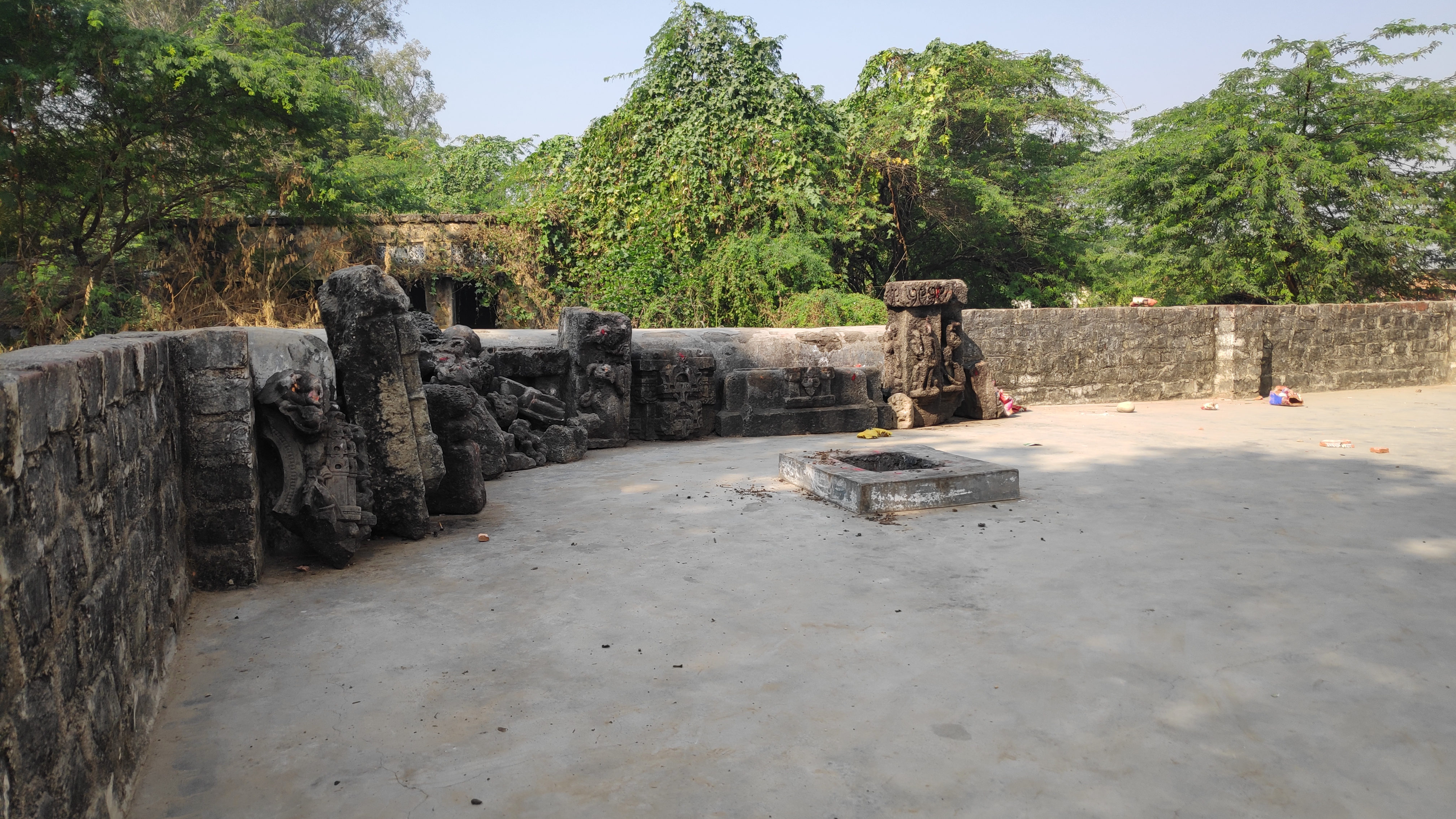 |
| Sculpture Shed, Khambahauli. |
 |
| Ancient sculpture from ancient temple, Khambahauli. |
 |
Ancient sculpture from ancient temple, Khambahauli. |
 |
Conversation with the villagers in Khambahauli. |
 |
| With my host shri Praveen Kushwaha ji who guided me in and around Newal. |
Xuanzang has mentioned that the Ashokan stūpa was situated on the banks of Ganges. Presently the Ganges flows 15 kms as the crow flies from Khambahauli. Cunningham in his report has mentioned that Newal was situated on the high bank of Kalyāni river which is an old course of Ganges (Cunningham1880: 49). Rameshwar Prasad ji recollected how the Kalyāni river which is now situated 3 kms south of Newal just a few generations ago flowed past Newal. Presently, Newal and Khambahauli both the villages are situated on the banks of Panchnaiyā rivulet (Panchnai Nala, Cunningham 1880:49) (see Map 1). Rameshwar ji also added that after flowing past Newal the Panchnaiyā rivulet merges with Kalyāni river. Seems the Panchnaiya rivulet is an ancient stream of Kalayāni or say the Ganges river.
Archaeological remains of Bhgawantpur Gote and Khambahauli fulfills all necessary conditions of distance and directions to be the two Ashokan stūpas to mark the sites where the Buddha gave sermons as documented by Xuanzang. Finds in these villages are compelling. These sites deserve study by competent authorities. These sites according to Xuanzang are sacred footsteps of the Buddha. I am sure, a little effort by stakeholders can save the Khambahauli mound from further decay. Few people whom I met in Khambahauli, I shared with them what these mounds in the village may represent and why it is important to preserve them for posterity.
Story chronicled by Surinder M Talwar.
Bibliography:
Beal, S.;1914, The life of Hiuen-Tsiang by Shaman Hwui Li by Kegan Paul. London: Trench Trubner and Co.
Cunningham, A.; 1880, Report Tours in the Gangetic Provinces from Badaon to Bihar, in 1875-76 and 1877-78 , Vol-XI, Calcutta: Office of the Superintendent of Government Printing.
Cunningham, A.; 1871. The Ancient Geography of India - I: The Buddhist Period. London: Trubner and Co.
Rongxi, Li; 1996, The Great Tang Dynasty Record of the Western Regions, BDK America, Inc.
Watters, Thomas; 2004, On Yuan Chwang’s Travels in India, (Edited by T. W. Rhys Davids and S.W. Bushell), Reprinted in LPP 2004, Low Price Publications, Delhi.
Legge, James; 1886, Records of the Buddhistic Kingdoms by Chinese monk Fa-Hien. Buddha Dharma Education Association Inc. Downloaded from http://www.buddhanet.net/pdf_file/rbddh10.pdf
2 comments:
Cunningham may have profited immensely by having you as an assistant
Vandami Cheytiang sabbang sabbhatansu pathittitang,
Saririka Dhatung,Mahabudhing,Sabbharung sakalang sada.
Great man great serve. All stupas must needed to be take care and protection. Those are national heritage. Should be erecting Buddhist flag very soon. Many thanks for Anand Ji, Sri Praveen Kushwaha Ji, Surinder M.Talwar Ji and others. Triple Gem always bless for all.
All the time regards by
Khemesh Barua
Post a Comment