As stated in the Buddhist tradition, after his enlightenment on the day of Veśāk Pūrṇimā (full-moon day of May), the Buddha, travelled eighteen leagues (1 League = 10 miles approximately) from Uruvelā (Bodhgayā) to Isipatana (Rishipattana, now Sārnātha). At Isipatana, on the day of Asāḷha Pūrṇimā (full-moon day of July), the Buddha preached his finds - the path to attaining enlightenment and reaching nirvāṇa - for the first time to five of his former colleagues. The first teachings of the Buddha are also known as the ‘First Turning of the Wheel of Dhamma’(It also means the Wheel of Law).
 |
| Sandstone image of the Buddha preaching the First Sermon (5th CE). @Sarnath Museum |
On my foot journey Retracing Bodhisattva Xuanzang (RBX), on 24th February, I embarked on the very significant trail from Bodhgayā to Sārnātha following the footsteps of the Buddha. My objective in this foot journey was to explore literary stories, local tradition and archaeological facts to identify the most probable route taken by the Buddha. My idea is to revive the ancient tradition of Cetiya Cārikā (Walking Pilgrimage) around this very significant event in history - the Buddha’s maiden journey to Rishipattana after his enlightenment to preach the first sermon.
All the early biographical texts on Buddha’s life like Mahāvastu, Abhinishkramana sūtra, Nidāna-kathā, Lalitavistara, Buddhacarita have mentioned (with slight variation) about the episode of travel of the Buddha to Rishipattana from Bodhi Tree (Uruvelā). But, these texts are slightly inconsistent with each other and hence are not of much use.
Please consider supporting the Retracing Bodhisattva Xuanzang Project
How your financial support are going to be utilised
Inconsistencies in Biographical texts
Biographical texts like Lalitavistara, Mahāvastu and Abhiskramana Sūtra have mentioned a set of places that Buddha visited on his way to Rishipattana from Uruvelā. But the names of the places and sequence in which Buddha visited them differs from text to text.
(i) According to Mahāvastu (Jones 1956: 314-320), the route that the Buddha took and the places he visited enroute were: Bodhi tree- Gayā-Vaśālā-Cundadvīla-Lohitavastuka-Gandhapura-Sārathipura.
(ii) According to Abhinishkramana sūtra (Beal 1875: 245-247): Bodhi tree- Chandra-Tchundajira-Karnapura -Sarathi- Rohitavastu
(iii) According to Lalitavistara: Bodhi tree- Gaya- Rohitavastu- Uruvelā-Kalpa, Anāla, and the town of Sārathi
Firstly, these three biographies present different sets of places where the Buddha stayed on his way. Only two places Rohitavastu (Lohitavastuka) and Sārathi are common in the three biographies which raises the question, which among these set of places - i.e. which text - is correct?
Secondly, the sequence in which two of the common names Rohitavastu (Lohitavastuka) and Sārathi appear in all three biographies is confusing. Mahāvastu and Lalitavistara mentions the Buddha first going to Lohitavastuka and then to Sārathipura. Abhinishkramana sūtra mentions the exact opposite.
Thirdly, unlike Lalitavistara and Mahāvastu, Abhinishkramana sūtra is silent about the Buddha even/first going to Gayā (from the Bodhi tree). Lalitavistra and Mahāvastu have mentioned that the Buddha went to Rishipattana via Gayā but Abhinishkramana Sūtra has not mentioned Buddha going to Gayā.
What could be the route the Buddha took?
 |
| Map depicting ancient and present Uttarāpatha and route of my foot journey. |
 |
| (Isolated) Bārā Hill. |
At the time of the Buddha, the routes did not pass through the green fields on both sides (as now). Unlike now when we have village/towns and cities at every one to two kilometres, there were far fewer villages at the time of the Buddha, sparsely placed, preferably settled around perennial water sources. The landscape through which the Buddha might have traveled is situated in the proximity of Kaimur Range (eastern portion Vindhyā Range), which is 80 kms wide and 480 kms long. This landscape was a dense forest until 100 years ago, teeming with tigers, leopards, bears, hyenas etc. So it is evident that the path Buddha took to Sārnātha passed through a dense forest.
According to Mahāvastu and Lalitavistara, from Bodhi Tree, the Buddha first went North to Gayā, and then travelled West towards Sārnātha. He could have directly gone (west) to Sārnātha from Bodhi Tree - a possible explanation why he went (north) to the Gayāsisha Hill is that some place near Gayāsisha Hill in Gaya could be the place where travellers and traders would get collected and travel only if there was a sizeable number of travellers. People preferred walking in groups. Besides the threat of bandits and wild animals, there were always chances of wandering off the routes. The routes passing through dense forests mostly had many routes, sub routes and tracks meeting, crossing and merging into them. Travelling in groups could take care of the dangers of meeting with wild animals or getting lost.
It is generally believed that the Buddha took the ancient Uttarāpatha, which is the present-day Grand Trunk road connecting ports in the Bay of Bengal on the eastern coast of India with Northern India and joining further with the Silk Road in Central Asia. But, the Grand Trunk road is situated 25kms south of Gayā. So the question is how the route connecting Gayā and the Uttarāpatha (that Buddha took) was.
Dr Vishwajit Kumar and Dr Arun Kumar, the teaching faculties in the Buddhist studies department of Nava Nalanda Mahavihara (Deemed University), Nalanda are of the opinion that there must have existed a route connecting isolated hills interspersed between the cities of Gayā and Aurangābād and that this route met the Uttarāpatha somewhere near Aurangābād.
Dr Shankar Sharma, Asst. Archaeologist (AA) at the Archaeological Survey of India (ASI) participated in an archaeological exploration and study in the years 2016-17 related with the ancient trade route, Uttarāpatha, where he traced ancient remains like inscriptions, religious structures, rest houses, mile markers, wells etc. in order to receive UNESCO World Heritage Site status for the ancient trade route, Uttarāpatha under the ‘Cultural Routes’. Based on his finds, he also thinks that a feeder route existed, connecting Gayā with the Uttarāpatha, and passing through the isolated hills of Pachrā Pāhār and Guruā, meeting Uttarāpatha at Deo in Aurangābād, which the Buddha may have taken.
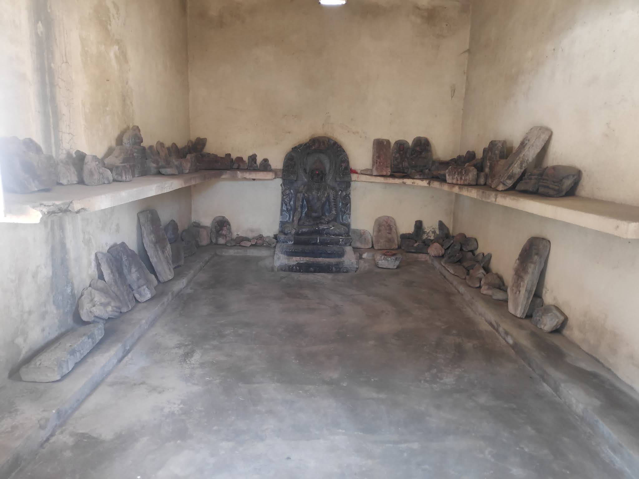
I started my walk very early on the morning of 24th February. I crossed the isolated hills of Baiju dhām and Bārā. These hills were visible from a distance, and I could imagine that during ancient times including the time of the Buddha, these hills must have served as a landmark. Walking 28kms, I arrived at Dubbā village. Dubbā is widely known for its vast Buddhist remains. The village has many sculpture collectives, the prominent among them is at a locality Bhurah (100m from Dubbā). Bhurah has a cluster of temples of different sizes. I noticed ancient sculptural remains inside and outside these temples. Since 2012, there has been a local committee called Bhurah Mahotsava Samiti (BMS), which works towards its preservation. Dubbā village rests on the remains of some ancient Buddhist monastery. Centuries ago, the people, ignorant of the significance of these remains, built houses over the mounds. Construction over the ancient mound continues even today. Only a few mounds are surviving which too are badly damaged because of brick robbing. There are so many ancient sculptures in the village, but people here are clueless about what to do with them. One can see the sculptural remains being reused as building material everywhere in the village. My hosts, Shri Ranjit Sinha (also spokesperson, BMS) and Shri Upendra Prasad, told me that in 2013, they created a village museum for its safety. According to both of them, Dubbā is slowly getting popular among the international Buddhist communities living in Bodhgayā. At the same time, villagers are also becoming aware of their heritage and its importance.
Shri Upendra Kumar serves in the position of CRCC (Cluster Resource Centre Coordinator). His job profile involves inspection of 13 government schools in villages around Dubbā. After having lunch at Upendra ji’s place, he asked me to join him on his inspection tour to the schools in the villages of Gudru and Piprāhi. On interacting with students of class 8 and 9 in the schools, I noticed that most of the students were aware of the Buddha and few had even visited Bodhgayā. Many villages in the proximity of Dubbā, like Guneri, have ancient Buddhist remains. Few of the students even thought with full conviction that Buddha must have visited their villages. I was pleasantly surprised at their level of awareness. According to the students, they learnt these things from their fathers.
In spite of vast ancient remains, Dubbā has not prominently featured in the reports by 19th and early 20th century explorers. According to Upendra ji, for a long time it was believed that Buddha on his way from Uruvelā (Bodhgayā) to Rishipattana (Sārnātha) may have passed through the village of Guneri. Guneri is 4 kms south of Dubbā and has many ancient images of the Buddha. Upendra ji is not convinced with this theory that the ancient route which Buddha took from Gayā to Rishipattana passed through Guneri. According to him, Dubbā is more suited to be on the ancient track as it falls in the line of the trail of isolated hills that runs between Gayā and the Grand Trunk road. According to Upendar Ji, the reason why Dubbā did not catch the attention of 19-20th century explorers and archaeologists as Guneri did, was because most of the sculptures in Dubbā were unearthed only in 2009 when the foundation for the government school building was being laid. Another reason could be that Guneri lies very close to the Grand Trunk road (only 3 kms south of it) whereas Dubbā was inaccessible by road until very recently.
 |
| Ancient remains of Dubbā. |
 |
| My host Shri Ranjit Sinha with ancient image of Buddha, Dubbā. |
 |
| Ancient remains reused in school building, Dubbā. |
 |
| My host shri Upendar Ji in his cowshed. |
 |
| An interaction with school children in Piprāhi. |
 |
| Ancient remains of Guneri. |
 |
| Ancient images of Buddha in Guneri. |
 |
| The trail along the irrigation canal. |
The next day, I started very early in the morning walking while it was still dark. I walked 12 kms along an irrigation canal, which joined the Grand Trunk road at Simri, 30 kms before Aurangābād. Upendra ji’s wife had packed a few rotis (flat bread) for me.
Walking more than 50 kms from Simri along the Grand Trunk road, I reached Dehri-on-Sone (Dehri) situated on the western bank of River Sone by noon of 26th of February. Sone is a perennial river and almost 5 kms wide at Dehri-on-Sone. During monsoons it is in its full fury, filled from bank to bank. River Sone must have been a big barrier and a major challenge in development of the trade route in ancient times. One can see the traces of ancient bridges on river Sone at Dehri dating from Moghul period (15-16th CE) and from the British period (17-18th CE). Dr Shankar Sharma who has done explorative study of the Moghul period bridge (15-16th CE) has found traces of stone pavements from very ancient times beneath the Moghul period pavement which Shankar thinks could be from before the Buddha’s time (6th BCE). Dr Shankar is of the opinion that Buddha on his way to Rishipattana from Uruvelā crossed the river Sone here at Dehri. Dr Shankar told me that because of sand mining activities in recent years, the ancient bridge on Sone has come under threat.
I started at about 4 am from Dehri, walking 18 kms along the Grand Trunk road from Dehri I reached the Tārā Chanḍi temple situated on the bypass highway 2 km south-east of Sasarām city. The temple is ensconced on the west side at the base of the Kaimur range. It appears the hill on which the Tārā Chanḍi temple is situated was cut to create the present Sasarām bypass highway. Sasarām has been important since ancient times; this is also exemplified by the fact that this place has an Ashokan Inscription (MRE I). The inscription was first seen and recorded in 1839 by Mr E. L. Ravensaw at a mosque dedicated to saint Chandan-Pir situated on the top of the eastern end of the Kaimur range.
I left the Sasarām bypass highway and took the meandering way along the base of the hill. Walking 2kms along the base of the hill, I reached the base of the Chandan-Pir pahād (hill). Just out of curiosity, I asked a few of the youth, who were playing cricket there, about the Ashokan Inscription site and all of them seemed to be ignorant. I was not surprised. My friend and advisor for the foot journey in the Kaimur area, Shri Shyam Sundar Tiwary, a government employee who has been very active in heritage exploration and preservation in Rohtās and Kaimur districts for more than 3 decades told me that the Ashokan Inscription site is protected by the Archaeological Survey of India (ASI), but for the last many years, the site is occupied illegally by the trustees of the Chandan-Pir Mosque. The site is always kept locked by the trustees because of which the new generation is ignorant about it. As people have stopped visiting the site, it is gradually passing out of the community’s memory. All ‘efforts’ of the District Administration to restore the custody of ASI over this site have failed.
The Ashokan Inscription site is a 10-minute climb to the mosque. I noticed the mosque was empty and only a caretaker was present. I asked him about the Inscription. With some resistance and hesitation, he finally showed me the rock shelter that has the Ashokan Inscription. It had a strong iron door, which was locked. He showed his inability to open it. The keys were with the trustees living in the Sasarām city. There are two rock cut tanks on the east and north-east of the mosque, possibly very ancient. This hill peak is situated south of the trade route (Uttarāpatha), and probably has been a religious place since ancient times. Emperor Ashoka therefore chose to inscribe his Dhamma message (Minor Rock Edict-I) here. The shrine on the top of the hill overlooks the ancient Uttarāpatha, which is situated less than 2 kms north from it. I can imagine traders and people in ancient times passing through this trade route stopping over to take a break from their journeys, parking their carts at the base of the hill and climbing to the top to offer prayers here. At some point of time in the 2nd millennium, Muslims took over this sacred place as it happened with numerous other shrines of significance.
There is a horizontal space between the roof of the rock shelter and the iron gate around 4 inches wide, from where one can peek inside the rock shelter with the Ashokan Inscription. I peeped inside trying my best to spot the Inscription somewhere inside the rock shelter, but could not. When I asked the caretaker about the Inscription, he shrugged his shoulders in ignorance. When I met Shri Shyam Sunder Tiwary ji later in the day, I told him about not finding the Inscription. Shyam ji has also not seen the Inscription in a long time and fears that the inscription may have been either obliterated completely or covered with a thick layer of lime by illegal occupants. Shyam ji further added that there was a notice board by ASI and the site was under lock and key under ASI. But in 2005, the mosque people removed the ASI board, destroyed the gate put by the ASI and put their own gate and since then it is under the control of trustees of the Mosque. It is very unfortunate local and international pilgrims who wish to visit the place cannot see the Edicts of Ashoka.
 |
| February-March is the time of growing Wheat. |
 |
| British period bridge (broken) on river Sone. Dehri. |
 |
| Bridge plate (British period bridge). Dehri. |
 |
| Sun Dial from 1871, near British period bridge. Dehri. |
 |
| Moghul period bridge on River Sone. Dehri. |
 |
| Myself at the Moghul period bridge. |
 |
| Grand Trunk bypass road, Sasarām. |
 |
| Walking along the hills. On way to the Ashokan Inscription site. Sasarām. |
 |
| Boys playing cricket at the base of Chandan-Pir Mosque hill. Sasarām. |
 |
| Chandan-Pir Mosque and rock-cut tank in front of it. Sasarām. |
 |
| View of Sasarām city from Chandan-Pir Mosque. |
 |
| Myself in front of the locked rock shelter that has the Ashokan Inscription. Chandan-Pir Mosque. Sasarām. |
 |
| View inside the rock shelter. Ashokan Edicts are supposed to be here. |
 |
| With Shri Shyam Sunder Tiwary Ji. Chandan-Pir Mosque. Sasarām. |
Shyam ji has done some very pioneering work in exploration and documentation of heritage especially of the rock art in Rohtās and Kaimur districts of Bihar. I had heard a lot of good things about his works so it was a privilege to meet him and listen to his experiences firsthand. Shyam ji got his inspiration from (a very pioneering archaeologist) Shri K K Mohammad, former Superintending Archaeologist, Patna Circle, ASI. Shyam ji met Shri Mohammad in 1999 when Mohammad ji visited Sasarām to inspect Domuhwā cave (cave with two mouths). The Domuhwā cave had some ancient rock art. This was the first time Shyam ji saw rock art and its significance and since then he is on the go. In the last 23 odd years he has found 160 rock shelters in the Kaimur hills with ancient rock paintings. Many of the rock shelters are precariously placed and inaccessible. He is now used to risking his life to document them. It is clear that he is very extremely passionate about rock art.
As Shyam ji was narrating his experiences, he suddenly became a bit melancholic. He told me that Bihar Heritage Development Society (BHDS, also Bihar Virasat Vikas Samiti), a Government of Bihar-funded NGO, is publishing a book on rock painting of Kaimur, which is originally his work, but they have not involved him. They could go to the site and make pictures of the rock arts identified by him without involving him because they had all the geographic information (latitude and longitude) from his published research papers. Shyam ji has become disheartened by this act of plagiarism. More so because he has done this exploration and documentation works out of his own resources without any assistance from the government. Shyam ji is a Librarian in All India Radio having meagre salary, out of which he supports his family as well as conducts his research.
I told Shyam ji that I was not surprised by what I was hearing. I had a similar experience with BHDS. My publication ‘The Pilgrimage Legacy of Xuanzang,’ published in 2016 by Nava Nalanda Mahavihara, Deemed University, Nalanda, met a similar fate. I filed a formal complaint to the Chief Minister Secretariat (complaint no. 2019011312, dated 06/03/2019) believing the government’s claims to ‘Zero Tolerance to Corruption’. It has been 2 years since then that I have not received any response from the Chief Minister’s office. Shyam ji said one reason for not involving him in the book on Kaimur rock painting could be that a sum of 96 lacs INR was appropriated for that photographic documentation although it would not cost more than 2 lacs INR. On hearing this, my mind went back to one of the BHDS meetings in which I happened to be present where Dr. Atul Verma, the Former Director of Archaeology Directorate, raised the question of why such a large amount was sanctioned for the photography. Dr. Verma’s inquiry was ignored by officials. Now it is to be seen how BDHS will justify this disproportionately large grant of 96 lac INR.
Plagiarism by unethical and pseudo-scholars is not new. Such people, as are appointed in BHDS, find their way to these important positions on caste-based political connections and these quacks hold on to these positions by greasing the palms of bureaucrats.
Read Part II- Uruvelā to Sārnātha- Maurya kā Maṭha (Part II)
Story chronicled by Dr. Aparajita Goswami
26.9-26.17
Falk, Harry.;2013, Remarks on the Minor Rock Edict of Aśoka at Ratanpurwa. Jňāna-Pravāha 16: 29–48.
Jones, J.J. (trans.); 1956, The Mahāvastu Vol.III, London: Luzac & Co.L
Neelis, Jason Emmanuel.; 2010. Early Buddhist Transmission and Trade Networks: Mobility and Exchange Within and Beyond the Northwestern Borderlands of South Asia. Brill.
https://www.jstor.org/stable/pdf/10.1163/j.ctt1w8h16r.9.pdf
Ravensaw, E. L.; 1840, Notice of Inscriptions in Behar, communicated by Mr. Ravenshaw. The Journal of Asiatic Society of Bengal Vol VIII, Calcutta: Bishop College Press.
Sinha, D. N., Sharma, Shanker., Tiwary, Sachin. Kr.; 2013, New Discoveries Tracing the Buddha’s route from the Place of Enlightenment to the First Sermon. History Today, Journal of History and Historical Archaeology, No.14. New Delhi: Indian History and Cultural Society.
Willemen, Charles; 2009, Buddhacarita: in praise of Buddha's acts: (Taishō volume 4, number 192) by Aśvaghoṣa. Berkeley, CA: Numata Center for Buddhist Translation and Research.
2 comments:
Here is some more details on Plagiarism regarding the Rock art in Kaimur done by Bijoy Choudhary. This work (documentation of Rock Art) is full of irregularities including formation of a sham committee by Bijoy Choudhary to get the work of Rock Art approved. The following is important in this regard:
a. Whether this work is a simple work of ‘Photographic Documentation’ or also involves archaeological exploration.
b. If this work approved by DACY and executed by BHDS involves Archaeological Exploration then ideally this needs to be duly approved by Archaeological Survey of India (ASI). Is the ASI involved in this?
c. If this work does not involve fresh archaeological exploration and requires only photographic documentation then what is the basis of this documentation? I.e. which are the published works that have been referenced by BHDS?
d. Shri Shyam Sunder Tiwary who has done pioneering work in the discovery of 160 rock shelters with ancient rock art, has published one research article titled, ‘Kaimur ke Aghura Prakhand mein. Shailasharya aur Shailchitron ki Nayi Khoj’ in the journal Prajna Bharti- XIX, K. P Jayswal Institute, Patna in year 2016. It is to be noted that Shri Bijoy Choudhary was the Director of K. P Jayswal Institute at the time of publication of this paper.
e. If BHDS has photo documented the discoveries done by Shri Shyam Sundar Tiwary then why is he not involved in the process, in spite of him being available.
f. If this work is only photographic documentation of the works of Shri Shyam Sundar ji then in that case why a huge amount Rs 96 lakhs were approved.
Approval of this work of photographic documentation of Kaimur Rock Art by the then Principal Secretary, Shri Ravi Parmar should be thoroughly investigated. Role of Shri Ravi Parmar is suspicious, more so because Shri Bijoy Choudhary managed to get an extension of three years in spite of the serious allegations against his initial appointment as Executive Director, BHDS. in March-2018.
Hi, nice blog, I am looking for information like this, photography is absolutely STUNNING, thanks you for posting this. spiti tour packages
Post a Comment